Petticoats in a twist on The Crinoline
- terrycornall
- Jan 27, 2022
- 4 min read

Updated: Jun 18, 2025
After missing out on any views from Mt Ligar during the McMillans Track trip, I decided that when I went back to retrieve the drop-barrels from that trip, I would solo Mt Ligar and see what all the fuss should have been about.

I waited for good weather, (not too long, I didn't want all the dirty clothing in the drop-barrels to spawn some new life-forms) and then headed out for Licola and beyond. Down to Volkswagen campsite to get the barrels and then back to Breakfast Creek where I left the car. I headed up to camp overnight on Mt Ligar in hot conditions, making sure I carried water because there wasn't likely to be any near the summit and I didn't want to have to go all the way to the Long Hill campsite to get it. I figured 3 liters would be enough for drinkies for two days plus dinner and breakfast...


The track up was easy and clear, though I did come across this fork in the path that wasn't on my map...

After a few hours, I got to where McMillans track crosses the track that continues up to Mt Ligar. Slight feeling of Deja Vu, though it had been raining last time I was there.

After a rest, I continued and came out on a false summit, to see that there was plenty left to go yet. Some boulders made an almost level 'road' for a few tens of meters.

Then there was a bit of scrambling up between bands of rock. Nothing too terrible, but it did require a head for heights and strength to pull oneself (and one's pack) up some steps.

Until finally I arrived at the summit, which had a lovely little copse of trees.

It would have made a great campsite, but I wanted to push on over the summit to get to one of the clear spots I'd seen previously, hoping to get to somewhere I could do some astrophotography.

So I went on over the other side, down past a rock I'd swear I'd seen before. (However, when I checked this photo against photos from McMillans Track blog, I could see they were different). It's a bit of a trap, trying to navigate by 'Go down by the rock that looks a bit like a wave' when quite a few rocks look like waves... The decomposed sandstone was very gravelly and slippery underfoot in places. I made good use of vegetable handholds.
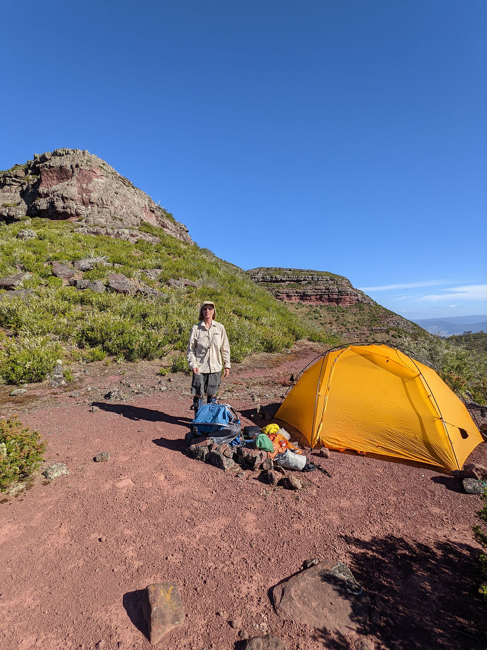
Anyway, with only a little bit of pathfinding difficulty, I got to where I wanted to be and put up camp with plenty of time for some scenic photography.


This video puts me and my little tent into perspective against the mountaintop.
That night, I tried to shoot some stars, but the fog rolled in. I did get this great shot of the moon-lit fog filling the valley during one short clear interval at zero-dark-ugly in the morning. It was freezing. Note to self: bring gloves next time...

Next morning, after a late breakfast...

I followed some cunningly hidden trail-sign to the way down...

Found a narrow ridge to traverse... big drops on either side but not very scary...

had a run-in with an old friend...

and made my way back to the car. Had run short on water so went and guzzled a liter from the creek. Upstream of the campsite...

BTW, if you are wondering about the strange-looking cap I'm wearing, it's got a specially modified bi-stable brim to allow it to fold up (and stay up) so when I'm gunning through the bush I can see branches and things that would otherwise knock me on the head. A bit like the idea of a cycling cap with a brim that folds back enabling the rider to see more without lifting his head all the time. Makes me look like a pillock, but allows me to remain a conscious one without head-injuries.
This was a great trip and one I'd recommend to anyone fit enough to do it. It does take some care at the 3 or 4 places where you need to do a few meters of rock scrambling. Also takes a bit of pathfinding to get up and down between the rock bands, but persevere and don't be afraid to backtrack if you get to a point that just looks too hard or exposed. Move around the band to find a better way. Do remember to take enough water...


